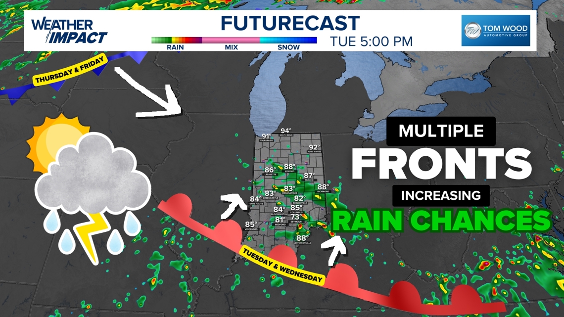
Scattered storms and pop-up showers are likely across Indiana this week due to frontal systems getting stuck overhead.
INDIANA, USA — Slow-moving fronts are heading toward Indiana and will bring increased rain and storm chances throughout the rest of the week.
Tap HERE to track pop-up showers and storms with our interactive radar.
Why this week matters
Mid-July is typically the hottest time of year in Indiana. While August can sometimes bring even more heat, we are currently in the peak period. That’s important because this is when cold air becomes limited across North America — and without cold air, fronts slow down or even stall out.
These rain opportunities remain important for the mid- and late-summer season. More shower chances mean fewer drought chances.
What happens when a front stalls
When a front stops moving or slows dramatically, it becomes what we call a stationary front. These stuck fronts can trigger repeated rounds of pop-up downpours and thunderstorms, especially in hot and humid conditions like we’re experiencing now.
Typical conditions with stationary fronts:
-
Slightly cooler or shifting winds north of the front
-
More muggy, storm-prone conditions south of the front
-
Storms can develop during the day and linger into overnight hours
Here’s what we’re tracking this week (July 15–19):
1. A front from the south
A boundary from last weekend over Kentucky is slowly drifting back into Indiana. It will arrive Tuesday and hang out overhead for a couple days, increasing the chance of passing showers and isolated storms.
2. A new front from the High Plains
This one arrives Wednesday night into Thursday. It’s expected to get stuck over Indiana, too, extending rain chances into the weekend.
Important: While there will still be periods of dry weather, scattered downpours could pop up at any time, including morning and overnight hours.
Stay weather aware, and check back for radar updates as we monitor how long these fronts will linger over Indiana.
