Severe thunderstorm warnings have been issued across Massachusetts (including in Greater Boston and Worcester) and parts of Connecticut and Rhode Island. For a full list of weather alerts in your area, click here, and explore live, interactive radar below.
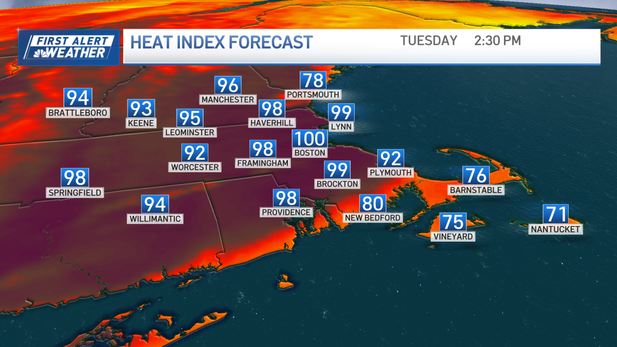
The heat bears down on us again — but unlike last Tuesday, we aren’t fiery hot, nor are we breaking records.
Heat indices are once again nudging 100 degrees in many spots, so please take it easy and keep it cool in the afternoon. Some clouds and a quick shower will give us the head fake early on, but sun will be bright and blazing for the afternoon.
Storms will pop up ahead of a cold front, but this isn’t an outbreak — and it doesn’t promise a lawn watering for everyone. Some storms may be strong enough for torrential rain and some wind gusts with the primary time frame of 4 to 10 p.m. The later they arrive, the weaker they’ll be.
Leftover sprinkles are possible early Wednesday, then the sun works in through the clouds. It’s still warm with highs in the 80s, but some of the humidity will be whisked away. It bumps up just a little on Thursday — enough to feed a quick afternoon shower or storm, then it vanishes for all of the Fourth of July.
Sun will dominate on that forecast, with highs climbing around 80. Without a lot of humidity, the temperature will drop quickly later at night on the Esplanade. Keep that in mind if you’re planning on spending the evening with the POPS and thousands of your friends.
The rest of the holiday weekend is bright with a warming trend. We should be back to 90+ by Sunday!
